Import from URL
Overview
Import a geospatial file from a public HTTPS URL without downloading it to your computer first. You can import directly into a Library folder or use Add Data Wizard to preview the source and choose its destination.
Use URL import for a direct link to a file. A link to a web page, sign-in screen, or file-sharing preview is not a direct file URL.
Before You Begin
- Sign in to an active AcuGIS Cloud account.
- Confirm that you have permission to add data to the destination Library folder.
- Copy a direct HTTPS URL for the source file.
- Make sure the server permits AcuGIS Cloud to download the file without an interactive sign-in.
- Know the source coordinate reference system (CRS).
The URL import form accepts .gpkg, .geojson, .json, .zip (shapefile), .tif, .tiff, .qgs, and .qgz files.
Test the URL first
Open the URL in a private browser window. If it downloads the file without asking you to sign in, it is more likely to work as a remote import source.
Step-by-Step
Import from a Folder
Use this workflow when you know which Library folder should contain the imported dataset.
1. Open the destination folder
Open My Drive, find the destination folder, and click Open Folder.
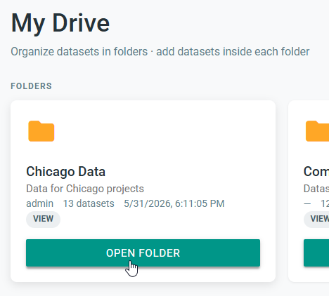
Caption: Open the Library folder that will contain the remotely imported dataset.
2. Select URL Import
Click Add Dataset, then select URL Import.
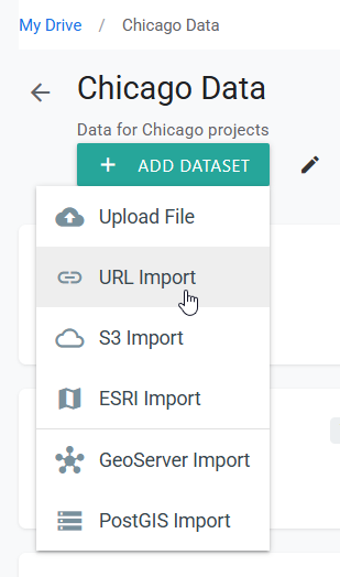
Caption: URL Import downloads a remote file directly into the current Library folder.
3. Enter the source details
Complete the URL Import form:
- Dataset name — enter a clear name for the Library dataset.
- Remote URL (https) — paste the direct HTTPS URL, including the file extension.
- Optional version label / message — add context such as the source date or release name.
- Import to PostGIS — select this only when the file should also be ingested into PostGIS.
- Publish to GeoServer after ingest — select this when the ingested data should be published to GeoServer.
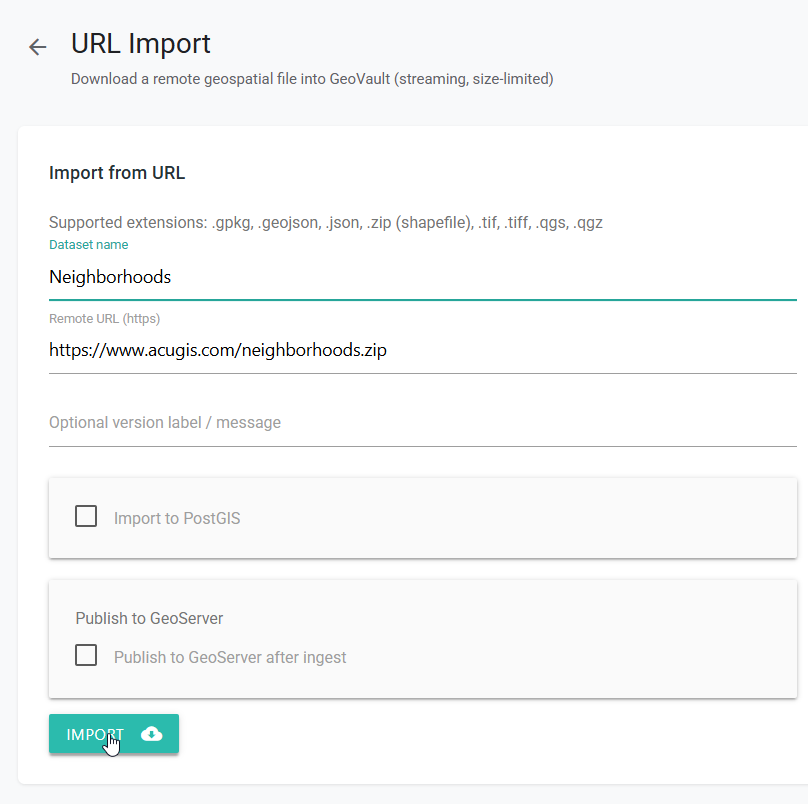
Caption: Name the dataset, paste the direct file URL, and choose any available processing options.
Click Import. Keep the page open while AcuGIS Cloud downloads and processes the remote file.
Optional processing
PostGIS and GeoServer options depend on the source type, configured services, and your permissions. Leave them clear when you only need the dataset stored in the Library.
4. Open the imported dataset
When processing finishes, return to the folder and locate the new dataset. Confirm that its type and version are displayed, then click View.
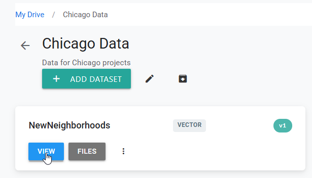
Caption: The imported dataset appears in the selected folder with its current version.
5. Verify the import
Open Versions and confirm that the URL import is marked latest. Click Preview, then check the layer extent and feature locations on the map.
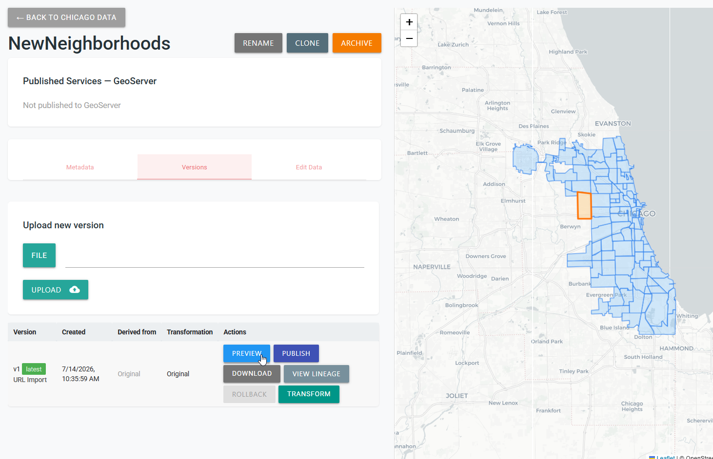
Caption: A latest version entry and correctly located features confirm a successful URL import.
Import with Add Data Wizard
Use Wizard when you want to inspect the remote source before choosing whether to store it in the Library or import it to PostGIS.
1. Open Wizard
Open Administration, then select Wizard.
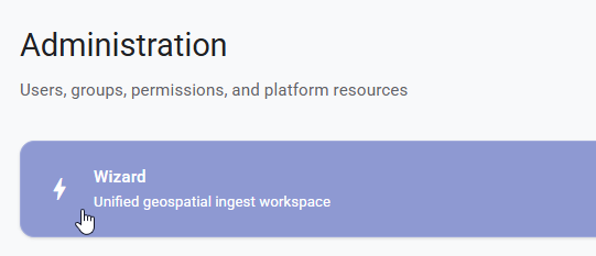
Caption: Wizard opens the unified geospatial ingest workspace.
2. Select Data Files
Click Add Source, then select Data Files.
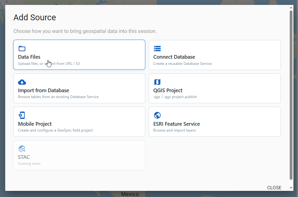
Caption: Data Files contains the local upload, URL, and S3 source methods.
3. Select URL
In the Data Files dialog, select URL.
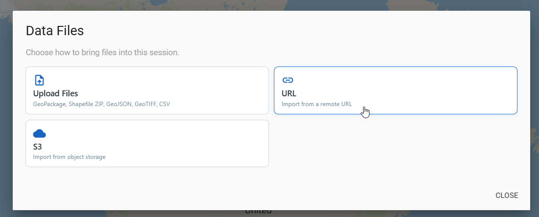
Caption: Select URL to load a remote file into the current Wizard session.
4. Add the remote source
Enter a Dataset name and paste the direct file URL. Click Add Source and wait while Wizard retrieves and analyzes the file.
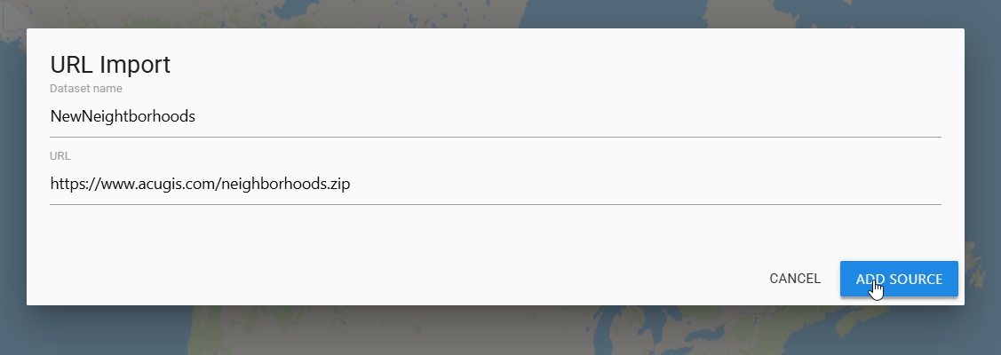
Caption: Add a descriptive dataset name and a direct URL that AcuGIS Cloud can access.
5. Review the source
Wait for the source status to show Ready, then inspect the map preview and the Details panel. Check the detected file type, layer count, geometry, CRS, feature extent, and warnings.
Resolve CRS warnings
If Wizard reports Missing CRS, verify and define the correct CRS in the source file before importing it. An incorrect CRS can place features outside the expected area.
6. Select the destination
Select the target Library folder, then choose Store in Library or Import to PostGIS.
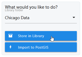
Caption: Choose the destination folder and whether to store the source or ingest it into PostGIS.
Follow any additional prompts for the selected action. When processing completes, open the dataset in its Library folder and verify the latest version and map preview.
Tips
Prefer stable source URLs
Use a URL intended for direct or automated downloads. Temporary links with expiring query parameters can stop working when you later need to repeat the import.
Record the source version
Use the optional version label or message for a publication date, release number, or other identifier. This makes the dataset history easier to audit.
Validate more than the status
After import, inspect the feature extent, several attributes, the CRS, and the layer count. A completed download does not guarantee that the source data was interpreted correctly.
Common Problems
The URL opens a web page instead of a file
Copy the site's direct download link rather than the address of its preview page. The URL should return the file itself without requiring buttons, forms, or an interactive sign-in.
The remote server rejects the request
Confirm that the URL is public and uses HTTPS. The source server may block automated downloads, require cookies or credentials, restrict requests by IP address, or reject redirects. Move the file to an accessible server or upload it from your computer instead.
The URL has expired
Generate a new link and retry. For repeatable imports, use a stable URL rather than a short-lived signed link.
The format is not accepted
Confirm that the URL ends in a supported extension: .gpkg, .geojson, .json, .zip, .tif, .tiff, .qgs, or .qgz. For a shapefile, provide a .zip containing all required shapefile components.
Import does not finish
Check that the remote file is still available and that your connection is stable. Large files can take longer because AcuGIS Cloud must first download and then process them. Retry with a smaller source to help isolate a file-size or server-timeout problem.
Features are missing or appear in the wrong location
Open the dataset preview, select the expected layer, and zoom to its extent. Check the source CRS and geometry. Correct a missing or incorrect CRS in the source and import it again.
PostGIS or GeoServer options are disabled
These options depend on the source format, configured services, and your permissions. Store the dataset in the Library, or ask an administrator to confirm that the required service is configured.