Collect
Field collection
 Atlas Survey
Field GIS
A complete field GIS solution for collecting data, synchronizing it to PostGIS, and using it in mapping, reports and dashboards.
Field teams collect and update data with QFieldCloud, Mergin Maps or ArcGIS Survey123. GeoSync writes those updates to PostGIS. QGIS Publisher, GeoDrive, Reports and Dashboards make the synchronized data available for mapping, sharing and analysis.
QFieldCloud · Mergin Maps · Survey123 · PostGIS · QGIS
Field to web GIS
Collect
Field collection
Atlas Survey
GeoSync to PostGIS
Web GIS
QGIS Publisher
Analyze
Reports
Product Demo
Watch the field GIS workflow from mobile collection through synchronization and web mapping.
Atlas Survey includes the applications needed to collect, synchronize, map, store, report on and dashboard field GIS data.
Publish QGIS projects as browser-based web maps from the same GIS work your team already maintains.
Organize, import and publish spatial datasets in a centralized workspace connected to your GIS applications.
Run and share reports from live PostGIS data, maps and operational field datasets.
Present synchronized field data in interactive dashboards for operations, review and reporting.
Synchronize QFieldCloud, Mergin Maps and Survey123 project updates into PostGIS automatically.
Three stages connect field work to the rest of the GIS environment — without copying datasets by hand.
01
Field users collect and update data with QFieldCloud, Mergin Maps or ArcGIS Survey123 — including existing hosted accounts.
02
GeoSync writes field and QGIS project updates to PostGIS on the interval you set — local or remote.
03
Synchronized data is available for web mapping, sharing, reporting and dashboards.
Atlas Survey includes everything in Atlas plus GeoSync.
QGIS Publisher GeoDrive Reports Dashboards
Atlas Survey: Atlas + GeoSync
Field Collection
Bring existing field services into one PostGIS-backed GIS environment.
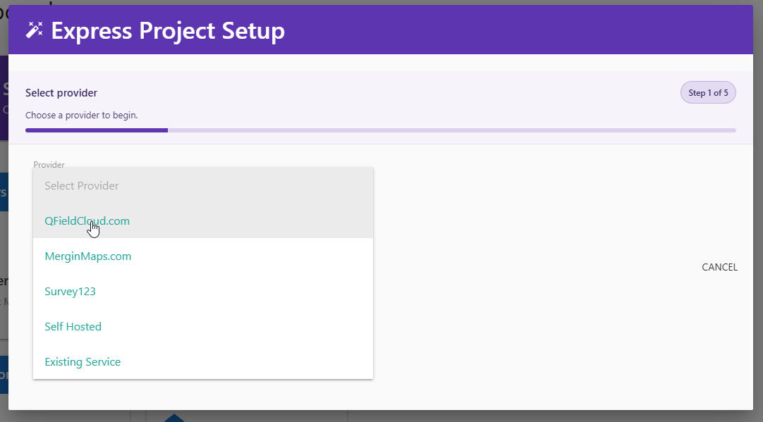
Atlas Survey works with QFieldCloud, Mergin Maps and ArcGIS Survey123. Use the account or server you already have, or add a dedicated QFieldCloud or Mergin Maps server from AcuGIS.
QGIS Workflows
Atlas Survey is organized around QGIS projects, not a separate field desktop.
Add the QGIS project in GeoSync and field updates are written to PostGIS. GIS teams continue reviewing, editing and publishing in QGIS and QGIS Publisher instead of moving files between field and office by hand.
GeoSync & PostGIS
Select the QGIS project, set a sync interval, and start the service.
GeoSync keeps office GIS working from the same spatial database field teams update. Create a new PostGIS database or connect an existing local or remote database as the authoritative store.
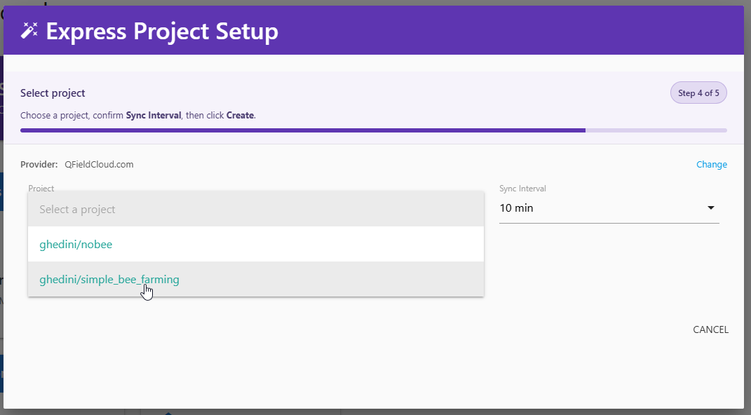
When field devices can reach the provider, updates flow through GeoSync into PostGIS so maps and reports stay current.
Field work can continue when connectivity is limited. Data synchronizes when QFieldCloud, Mergin Maps or Survey123 is reachable again.
Use a database on the Atlas Survey service or connect a remote PostGIS database. Local databases remain accessible remotely as well.
Capabilities that keep field GIS connected to the rest of the AcuGIS environment.
Capture and update features in the field with QFieldCloud, Mergin Maps or ArcGIS Survey123.
Synchronize the QGIS project itself. Desktop GIS teams keep authoring and reviewing in QGIS.
QGIS Publisher turns the synchronized project into a browser map for sharing and operational use.
Keep spatial datasets organized in a workspace connected to publishing, mapping and analysis.
Generate reports from live PostGIS layers, maps and field attributes without a separate extract.
Monitor field activity and operational GIS with dashboards on the synchronized data.
Automatic field-to-PostGIS synchronization for hosted or self-hosted collection services.
Optional QFieldCloud or Mergin Maps servers when you need a dedicated collection environment.
Run Atlas Survey as a hosted service, or deploy on infrastructure you control.
AcuGIS hosts and operates the Atlas Survey environment, including GeoSync, QGIS Publisher, GeoDrive, Reports, Dashboards and PostGIS, in your choice of locations.
Run Atlas Survey on infrastructure you control — your servers or your cloud account.
Choose resources, an optional dedicated field server, and a hosting location. QGIS Publisher, GeoDrive, Reports, Dashboards and GeoSync are included.
Can be scaled at any time.
Use your existing QFieldCloud, Mergin Maps or Survey123 service, or add a dedicated server.
Select where the managed service is hosted.
Prices are monthly and do not include applicable taxes. The final price is shown at checkout before payment. Compare Atlas Survey with other AcuGIS products on the Pricing page.
Have additional questions? Contact us.
Atlas Survey works with QFieldCloud, Mergin Maps and ArcGIS Survey123. QFieldCloud and Mergin Maps can be self-hosted or used through qfieldcloud.com or merginmaps.com. Dedicated QFieldCloud and Mergin Maps servers are available as optional add-ons.
Yes. Atlas Survey is designed to work with an existing QFieldCloud or Mergin Maps account or server. You do not need a dedicated field server unless you want one.
Yes. ArcGIS Survey123 is a supported field collection platform. GeoSync synchronizes Survey123 data into PostGIS alongside QFieldCloud and Mergin Maps workflows.
Yes. When you add a project you can use a local database or a remote PostGIS database. Local databases on the service are also accessible remotely.
Yes. Resources can be scaled at any time as collection, storage and mapping needs grow.
Yes. A dedicated QFieldCloud server is an optional add-on at $59 / month. You have full root access to the dedicated server.
Yes. A dedicated Mergin Maps server is an optional add-on at $59 / month. You have full root access to the dedicated server.
Web GIS Platform
Atlas is QGIS Publisher, GeoDrive, Reports and Dashboards. Atlas Survey adds GeoSync for field collection and PostGIS synchronization.
Collect in the field. Synchronize with GeoSync. Map, report and dashboard from the same PostGIS data.